
Map Analysis - Map Of France As A Ship
Have a question about creating decorative or fantasy maps? Click here to send Philip your question.
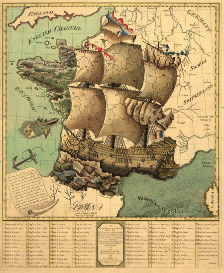
Here is an interesting map of the French Revolution from the Library of Congress. The map was created in London 1796. My cropped version omits the table of events of the revolution shown in the original on the left and right margins. The cartouche in the lower left corner reads...
The Kingdom of France is represented under the form of a ship, that, being the arms of Paris, and that City being known on the 13th and 14th of July 1789, by its insurrection, to have given so great a shock to the monarchy, that its influence extended to all the provinces, except those distinguished as land. The Vendeans remaining stedfast in the Royal Cause, and to the present time preferring death to a renunciation of their principles: are supposed, embarked, to recover the lost standard of their ancient Constitution.
Read more mapping articles. Click here to return to the articles list.
What are your mapping problems? Answer a few survey questions and tell me what information you would like me to publish. Click here to fill in the survey.